The Northville Placid Trail was my first true backpacking adventure. I spent a lot of time planning and researching it and it is my hope that others will be able to use this trip report to assist in their planning and preparations for the NPT or another similar trail. I also wanted to share my story of this adventure with friends and family so this is my way of doing that as well.
Before I launch into the nitty gritty of my adventure I would like to thank the Northville Placid Trail Facebook group for their invaluable advice and generous time spent answering all of my questions. I hope to meet some of the folks over there in real life at some point and also give back to the group and volunteer to do some trail work. Thank you!
NPT: Why?
I was visiting with a relative last summer and we got to talking about backpacking and how much we would both love to get into it more. She shared with me the book Hiker Trash and I devoured it. I wanted an adventure like that! We tentatively planned to hike the Long Trail in Vermont in the summer of 2017 and I knew I needed to get some better experience before I could consider hiking the Long Trail. What I learned from the NPT is that I need to do a lot more training before I can tackle the Long Trail, which is widely considered to be the most difficult thru hike in the US.
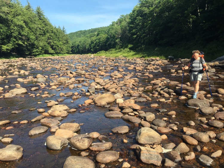
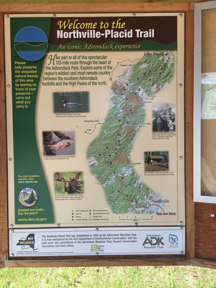
I began researching backpacking trails and as soon as I read about the Northville Placid Trail I knew it would be a great trail to start out on. Two specific things about the trail really stood out to me: 1) It’s mostly flat and 2) There is easy access to water along the entire trail. Being able to avoid 4000+’ ascents while carrying an additional 10# of water seemed wise.
Step One: Become Obsessive and Find a Backpacking Partner
Everything I do I do a little obsessively and planning for this trip was no exception. Honestly, sometimes I can be slightly unbearable to those around me. My (amazing) friends and family endured 6+ months of one-sided discussions about very specific lightweight gear options (one friend observed: hammock backpacking is a niche trend within a niche hobby) and musings about hiking the NPT, plus endless hours of coordinating who would be where, when, and how they would get there.
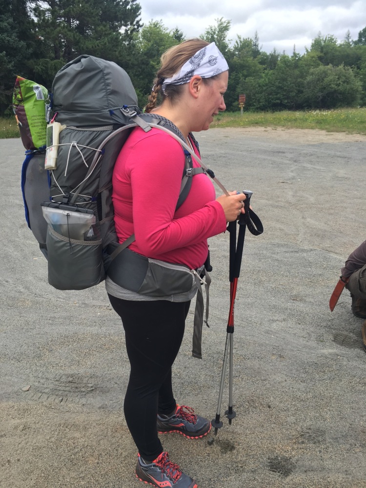
I convinced one of my co-workers that she should do the entire trail with me and she (way too quickly) agreed. I’m not sure she had any idea what she was getting herself into but she did know she needed a 12 day mental health break in the woods so she just said Yes and never turned back. And this is why I love her.
Sidenote: My hiking partner really needed to get away from it all and spend time processing life. She cried for pretty much the entire first four days on the trail and thus earned the trail name “Trail of Tears.” Henceforth I will refer to her as ToT.
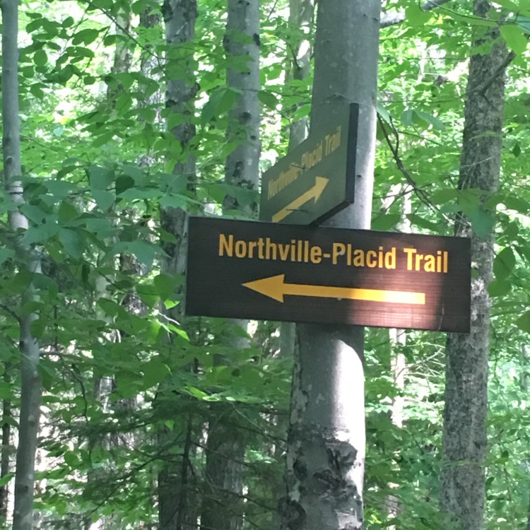
Section 1: Lake Placid to Long Lake
Day 1: Logistics
A huge part of planning a thru hike is figuring out all the logistics. For me this included the usual thru-hiking stuff – resupply, having cars in the right location, figuring out a schedule and trying to stick with it – but it also involved sorting out plans for my 6 and 9 year old daughters for 12 or 13 days.
We had decided to hike the NPT Southbound (SOBO) because if we had gone NOBO (like most people do) we would have hit Lake Placid right before Ironman Weekend and that didn’t seem like the ideal time to be up there. Plus there is something appealing about the idea of walking south towards home.
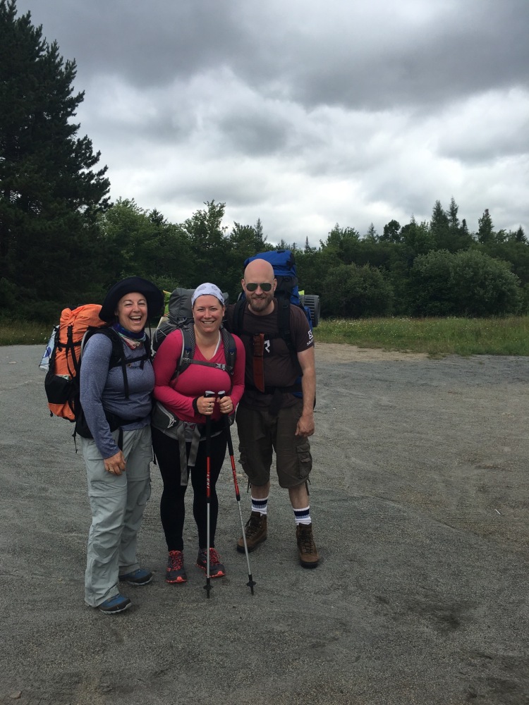
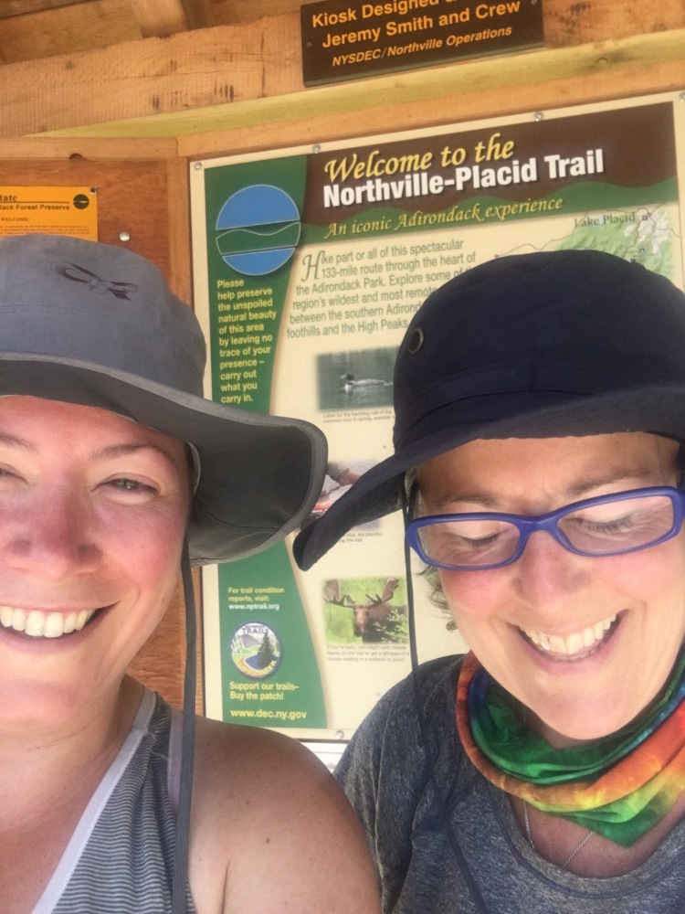
Day 1 found us caravanning up to Lake Placid. First stop was my folks camp in Indian Lake. There I swapped my kids for my dad and we continued on to the NPT trailhead in Long Lake where we dropped off another friend Michele’s car. Michele was planning on section hiking from Lake Placid to Long Lake with us and having her car at the end of her section hike was perfect. Finally we all piled into my car and got to the Lake Placid trailhead around 10:45. Right on time!
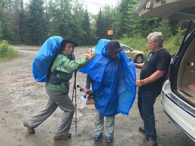
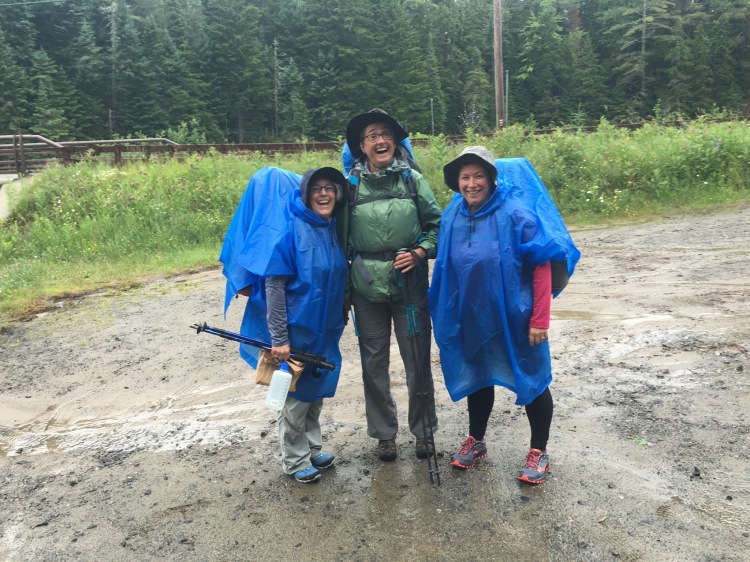
As soon as we pulled in it started to rain pour. The rain really added an exciting element to the trailhead scramble – everyone pulling their gear, lunches, extra stuff they added at the last minute, water bottles, cell phones, etc. out and cramming it into our backpacks. ToT had stuff everywhere and my dad was so awesome helping us all to get it together and get going.
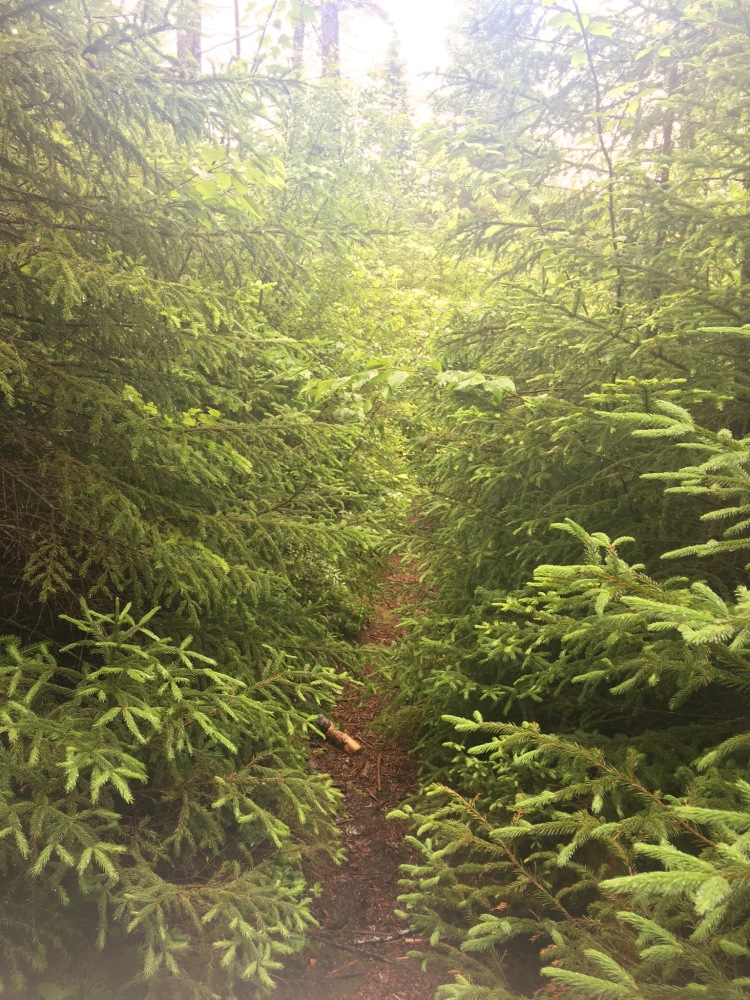
The plan on Day 1 was to hike in about 8 miles to the Moose Pond Lean-to. The hike in was, well, wet. And our packs were heavy! But the rain seemed to deepen the colors of the forest and we were in good spirits (we were too inexperienced to know how much this sucked). It was a long walk but eventually we made it to the Moose Pond LT around 6 that evening.
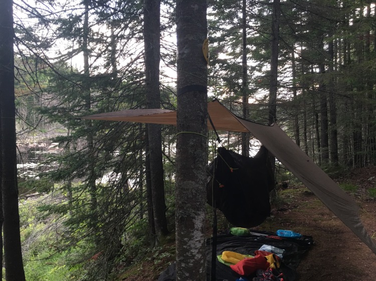
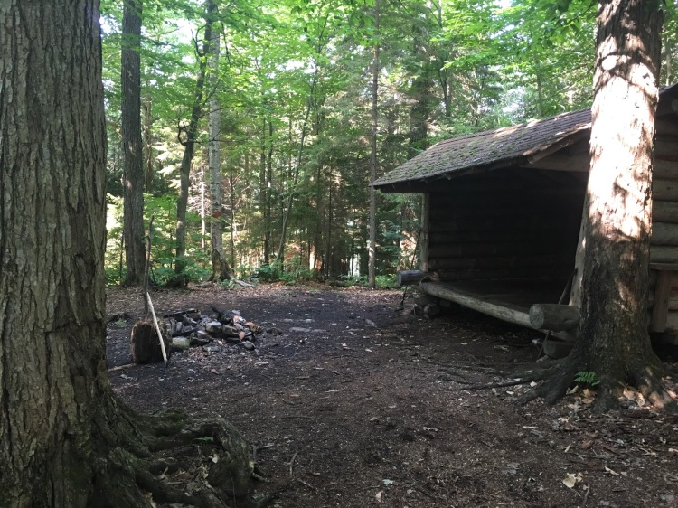
When we arrived at the Moose Pond Lean To (Lean To = LT) our first order of business was apparently to scare the bejesus out of Harold, another section hiker, who had spent the day in the peaceful silence of the LT waiting out the storms. We quickly destroyed any vestige of tranquil solitude but luckily for us Harold was a true trail angel in every sense. He quickly reorganized the LT and convinced ToT to put up her tent in there and bunk with him out of the rain that night (Michele and I were sleeping in hammocks). He was an experienced thru hiker and offered much advice in such a kind-spirited and gentle manner. Harold, if you ever read this, thank you for everything our first night out on the trail! We are deeply grateful for your generous and supportive nature, encouraging words, and truly helpful advice.
Day 2: Our favorite LT: Seward
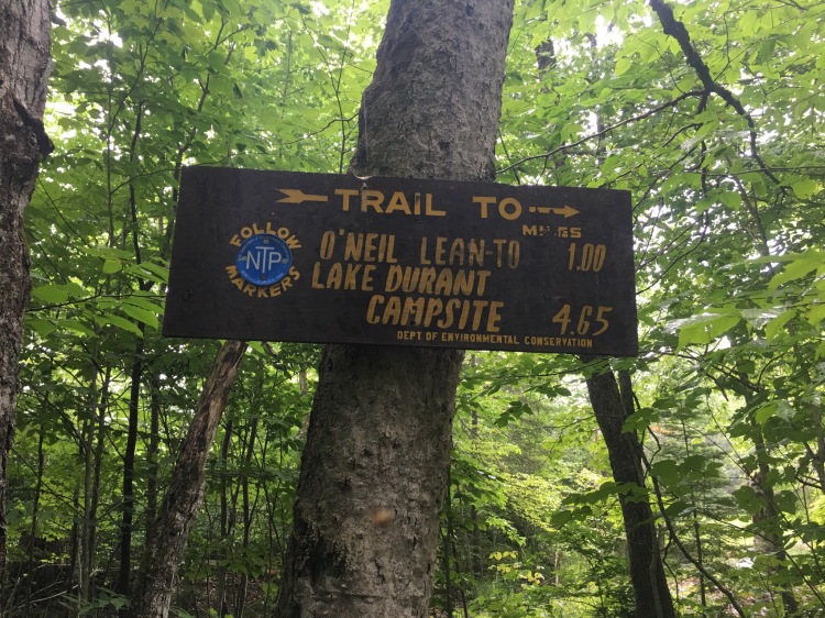
We woke up on day 2 to the sun shining, birds singing, loons…looning?. We knew it would take a while to get organized and back on the trail but we did manage to get back at it by 10 AM. Our goal that day was to go about 10 miles to the Seward LT. Before setting out I had posed a question to the NPT FB group about the best lean to and campsites on the trail. Seward came in on top of everyone’s list so I made sure to plan to spend a night there. And wow, this LT did not disappoint!
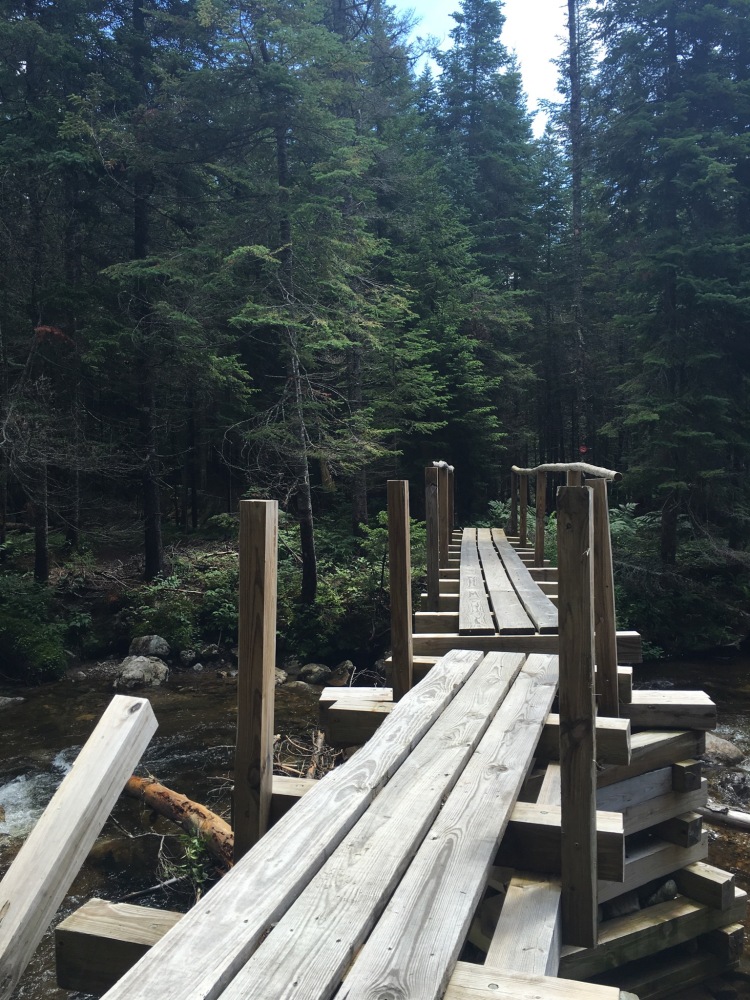
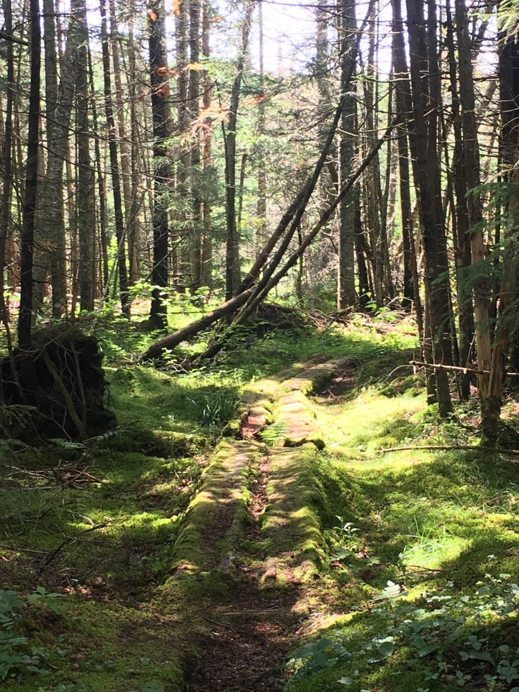
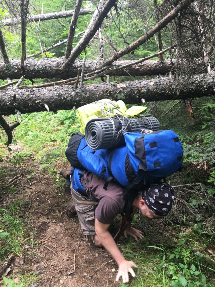
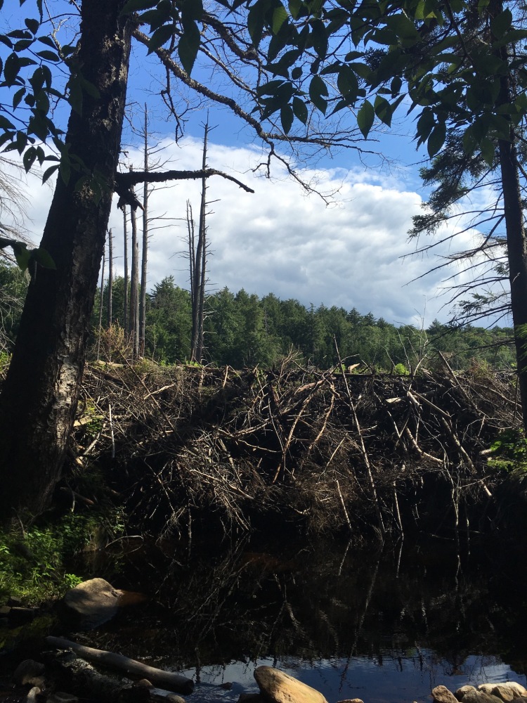
Our hike on Day 2 was full of trail obstacles and a little more difficult than Day 1. There was a lot of slippery foot bridges to negotiate, a whole section of beaver damage to circumnavigate (I think this entire section is being rerouted very soon), and we were carrying too much – too much food, too much stuff. We were all still learning the art of packing our backpacks correctly and we were tired and a little sore from the hike in the day before.
We briefly discussed stopping at the Ouluska LT about 2 miles before Seward but I lobbied hard to keep moving and no one regretted it when we finally arrived at our destination.
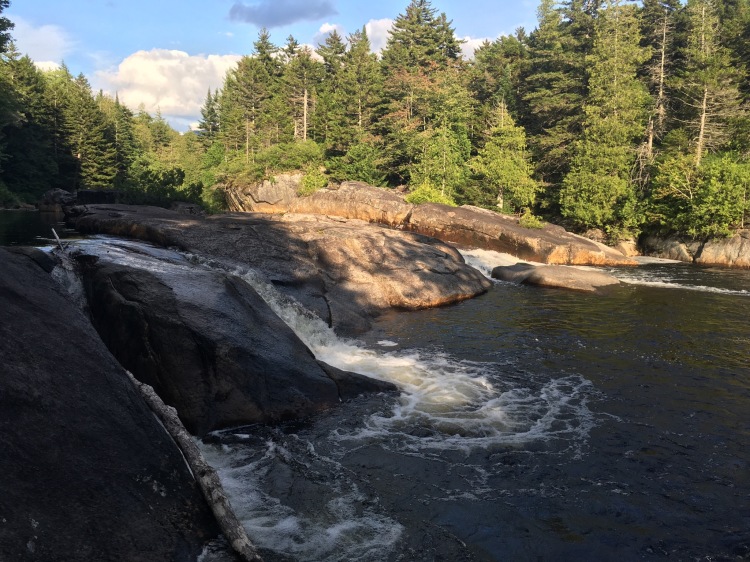
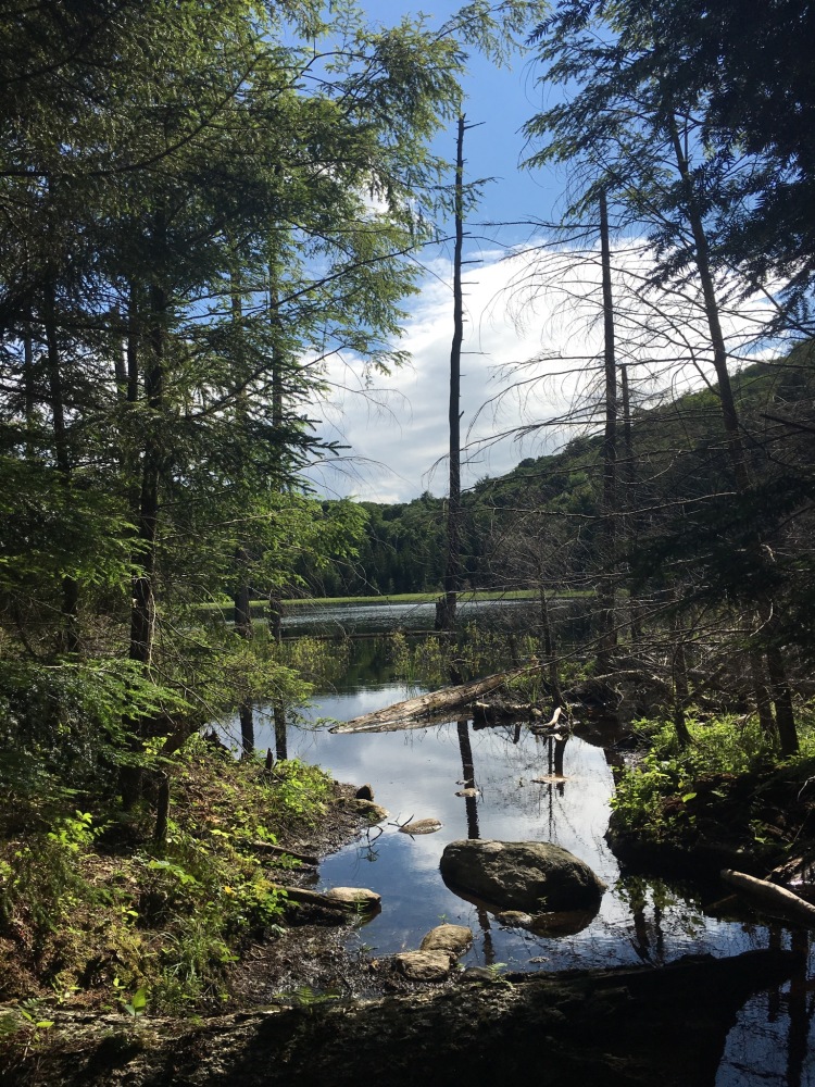
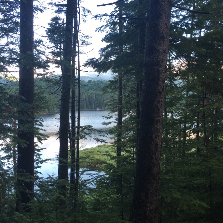
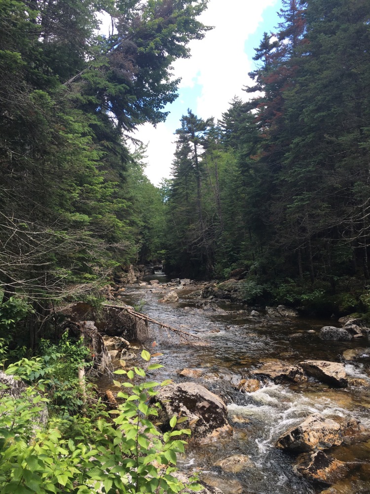
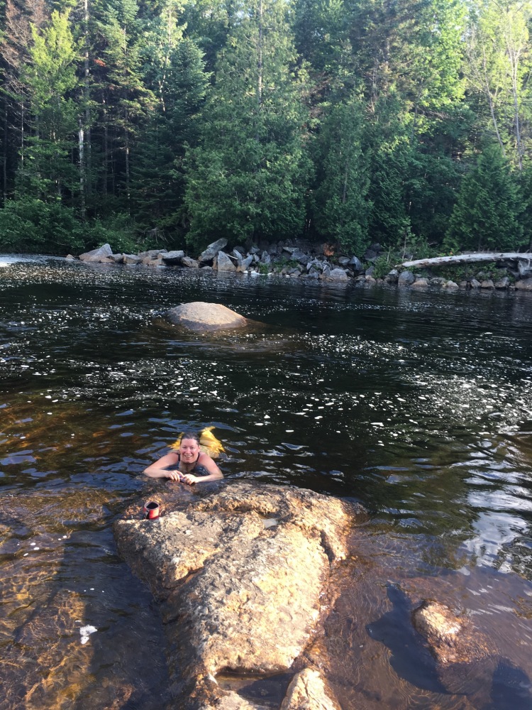
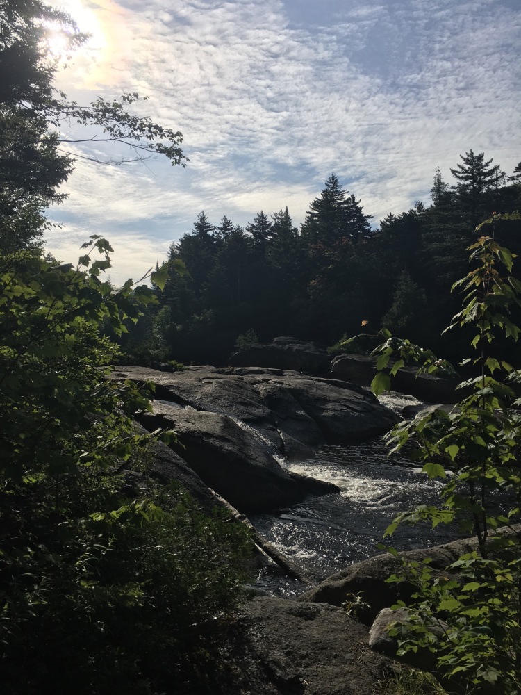
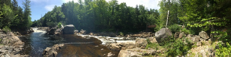
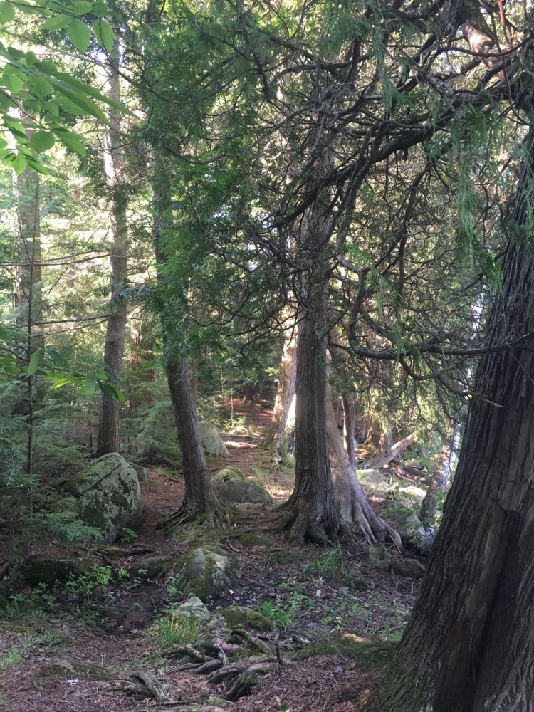
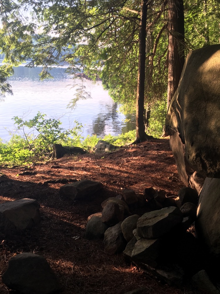
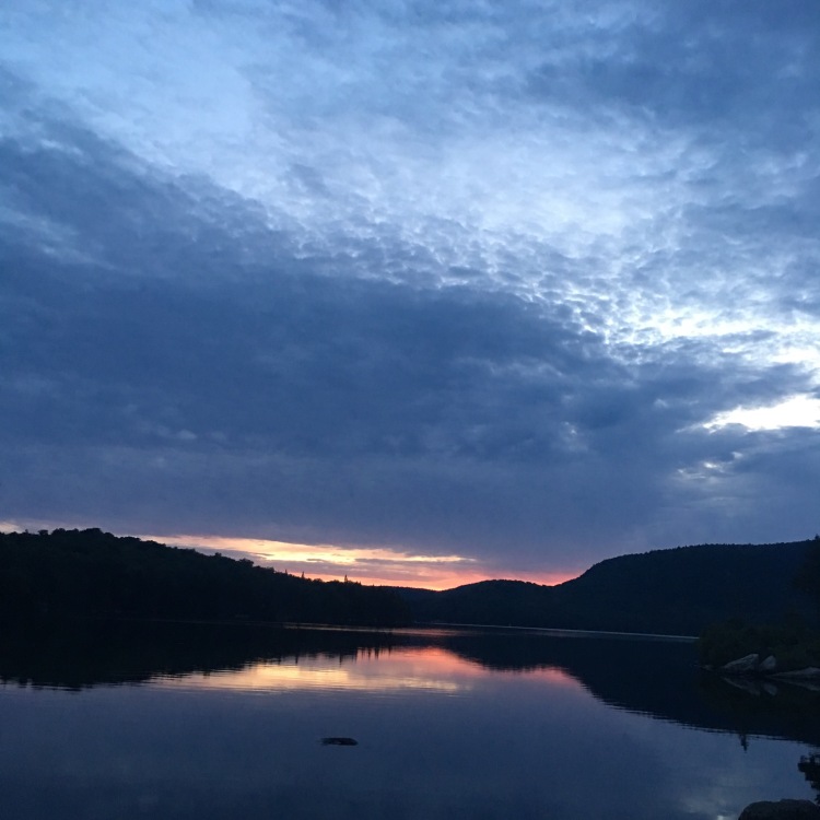
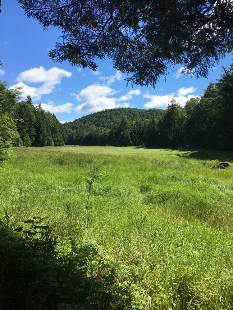
We arrived at the Seward LT and found it unoccupied and picture perfect. The LT sits right next to the Cold River and overlooks Miller’s Falls. We were pleasantly surprised to find out that the Cold River was actually not that cold and we could swim at the base of the falls. Before setting up camp we poured some wine and took a dip in the falls. It was exactly what we needed. The water was soothing and the scenery was stunning. We set up camp quickly that night and slept soundly with the sounds of the rushing river next to us.
Day 3: Bees, Bugs and a Long Lake!
We had assumed that packing up on Day 3 would be quicker, but it wasn’t. 🙂 While we were breaking down camp a troop of boy scouts stopped by hiking NOBO and Harold leapfrogged us heading SOBO. We were finally on the trail by 10am, again, but no one could complain about a few extra hours at such a beautiful spot.
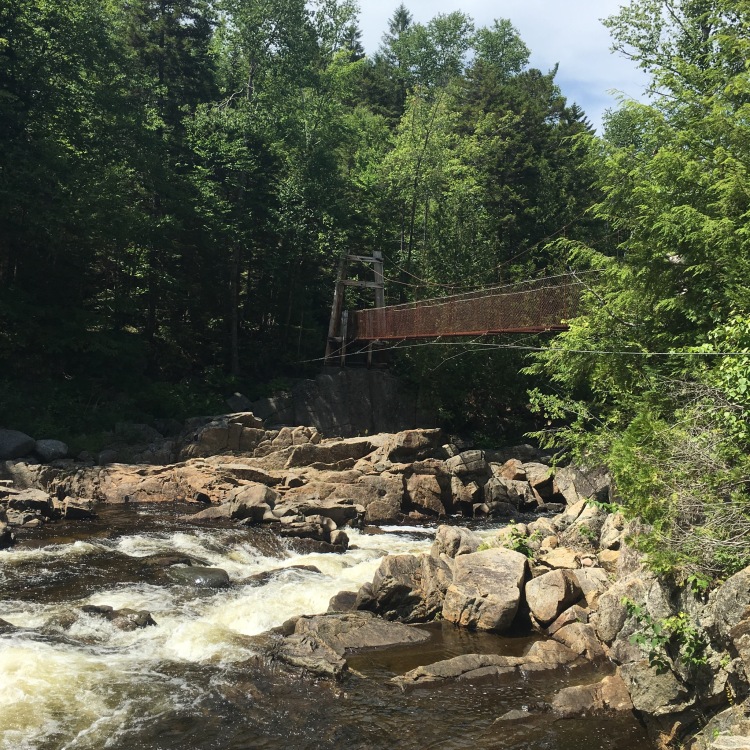
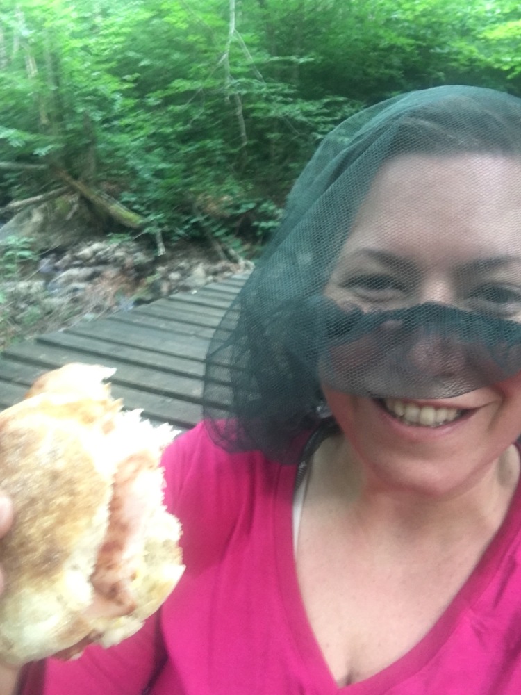
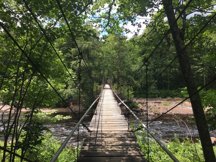
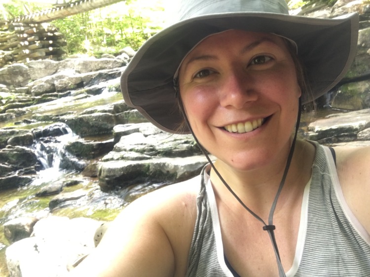
Our goal today was to hit Long Lake and decide where to stop once we got there. There are quite a few LTs along the shore all within a few miles. The day was sunny and warm and the hike along the Cold River was beautiful. We came to our first suspension bridge across the River around lunchtime and thought we would stop and eat…however, at the LT near the bridge we noticed that mixed up with the deer flies that were all around us were also a variety of bees. Maybe not a big deal for most but I am allergic to bee stings and not at all interested in testing out the protocol I was instructed to follow should I get stung (immediately use an epi-pen, followed by a dose of benedryl and prescription steroids that I was carrying for the occasion).
I attempted to move away from the bees in the LT only to feel like they were following me everywhere. Finally I took off running across the bridge and further down the trail where I waited for Michele and ToT to catch up. I must have run further than I thought because they were quite worried when they got to me and we decided we need to establish a whistle signaling system for the future.
After the drama of the bees subsided we hiked on. We ran into some section hikers going NOBO – a dad, his brother, and his two daughters, one of whom was only 9! It was great to talk to them and we were excited to see some kids on the trail.
Eventually we hit Plumley’s Point on Long Lake – the northern/easternmost LT along the trail on the lake. We stopped there for a dip in the water and ran into more bees. It was a hot and sunny day so the bee activity wasn’t much of a surprise but it was still unpleasant for me. As Michele pointed out, “You just have a different relationship with bees than I do.” Yes, this is true, it’s one of those potentially fatal relationships.
In the end I just stayed away from the structures and enjoyed the water. The swim was exactly what we all needed and afterwards we packed up and intended to walk two more miles to Rodney Point LTs. We walked, and walked, and walked. After what seemed like forever we came to a LT….but it was Kelly’s Point, not our intended Rodney’s Point. We had hiked right past the turnoff for the LT and accidentally did another 10+ mile day.
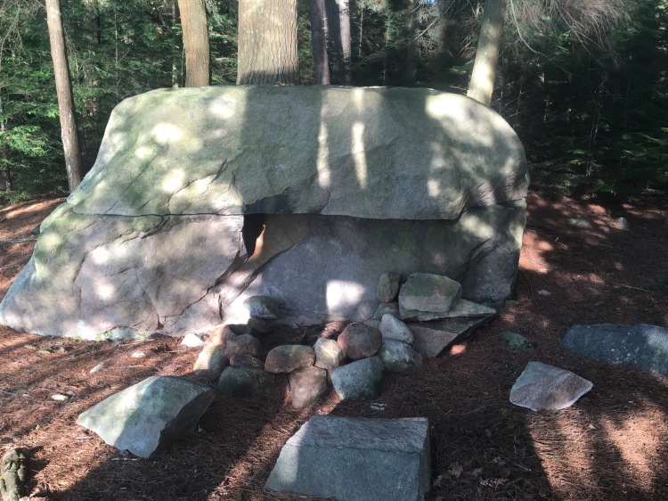
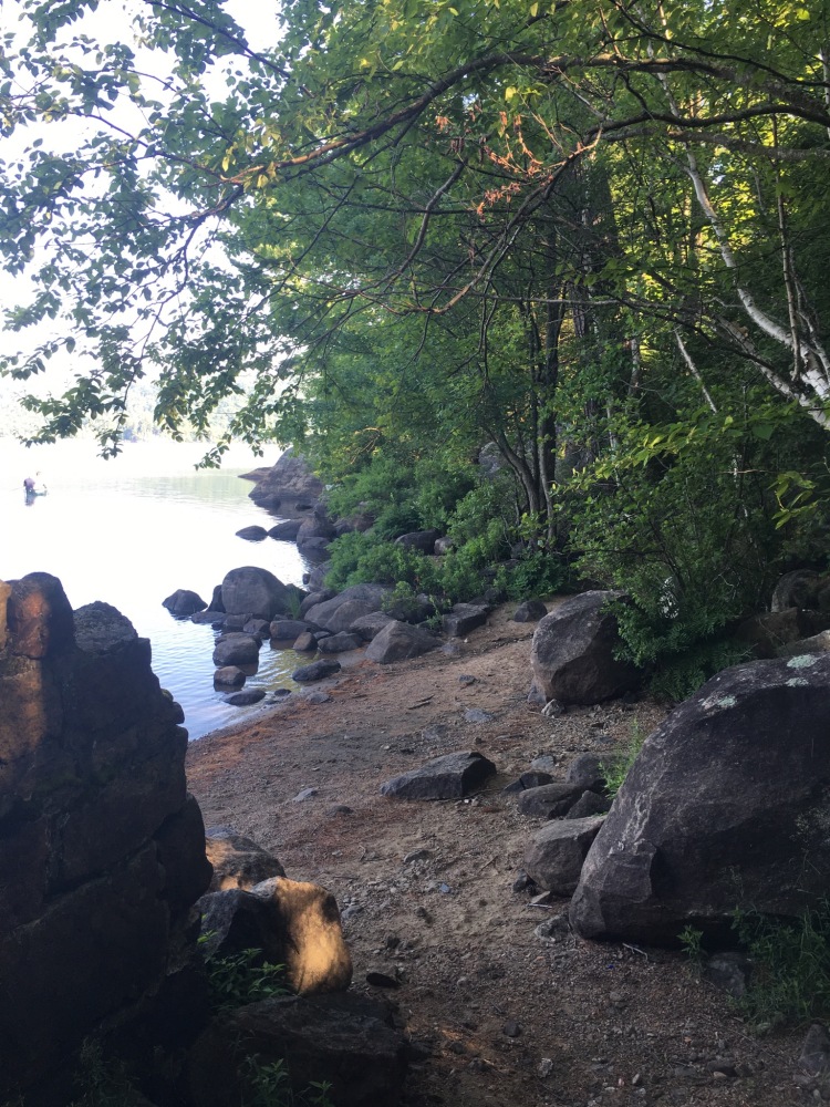
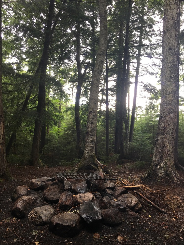
At Kelly’s Point we ran into Harold who had also missed Rodney’s Point, and Jerry, a kayaker who had paddled in and was camping for a few nights. Kelly’s Point had lots of space to spread out and after scouting the site we found a great campsite with a really cool firepit and easy access to a sandy beach that we could swim at.
We had a campfire and Jerry joined us that night. It was fun to get to know another camper and it turned out that he had spent a lot of time in the town where Michele had grown up. It is a small world after all.
Day 4: A Long Lake Break
The next morning rolled around and we were up and walking by… 10am. As a naturally early riser, this was becoming a trend I didn’t love. 🙂 My big insight on Day 4 was that I realized when backpacking, you will never wake up and regret walking more than you expected the day before. We looked forward to a short and easy hike into town and then an afternoon spent reorganizing what we had packed, resupplying, and catching up with our friend Beth who was meeting us there for the night.
Of course the hike out was exactly not what we had expected. Easy and short? Nope, hot, buggy, and uphill. We finally arrived at the trailhead on Tarbell Road but Michele’s car was parked at the trailhead on Rt. 28 – a little under a mile up the road. We didn’t know which way to walk on Tarbell Road to get to Rt. 28 and couldn’t find any signage. At this point the smart thing to do would have been to pull our the compass and the map and made an educated decision but we were hot and tired and thought it made sense to walk downhill towards the Lake. Nope! Wrong. After walking for a while I offered to ditch my pack and take the keys and run the rest of the way to the car. And so I did… I ran right into the dead end of the street. *sigh* We had walked quite a distance in the wrong direction in 90 degree heat on pavement. Doh! I hustled back to Michele and ToT and they offered to walk the other way and bring the car back. I immediately agreed and sat on the side of the ride and called my husband who I hadn’t talked to in 3 days. He was bringing me a few things in Long Lake on his way through with our kids and it was so nice to catch up for a few minutes.
After a little while Michele and ToT returned with a car… Harold’s car! They crossed paths with Harold at the Tarbell Road trailhead as they were passing it again and he graciously offered to give all of us a ride in the correct direction down the road to Michele’s car. We had that awkward time where we said “thank you” and “good-bye” for the 10th time in 3 days (and 6th time that day) and tossed our stuff into Michele’s car for the ride into Long Lake.
We had booked two rooms at the Shamrock Motel in Long Lake for the night and what a great decision that was! I am reputed to never stay in motels but this motel was nicer than many hotels I’ve stayed in. The owners were wonderful and offered to help us in any way possible PLUS they had laundry facilities onsite. What more could you ask for?
As soon as we got into our rooms the gear exploded everywhere, showers turned on, ToT ran into town to get her coveted Poland Spring water, and we got busy organizing and reorganizing for the next section of trail.
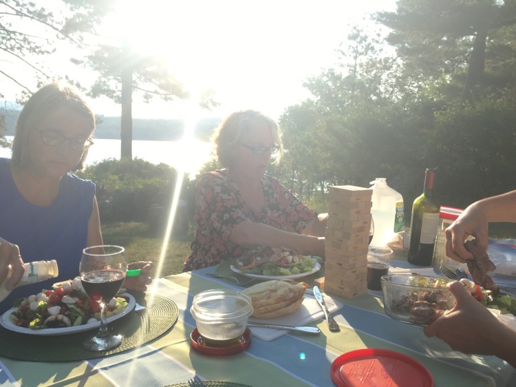
Stopping in Long Lake for the night was a really good idea. By then we had such a good sense of the trail and our specific needs, and we had made some great resupply accommodations for ourselves in Long Lake before we started hiking. Our friend Beth had originally intended on hiking the next section with us but she had a back injury and instead of hiking she made herself the most useful and amazing support person we could have asked for. She showed up to the motel in the late afternoon with a delicious homemade meal, lots of wine, and a willingness to support us however we needed.
I also had the truly amazing opportunity to see my husband and kids very briefly as they travelled from Indian Lake to a mini-vacation in Lake Placid and drove right past the motel where we were staying. To be perfectly honest, this trip was a little hard on my kiddos. They were worried about me and 13 days is a long time for me to be away. But they were surrounded by grandparents and extended family and friends and super well loved and super well cared for and I think it was important for them to see that I was alive and well even if it was another teary good-bye.
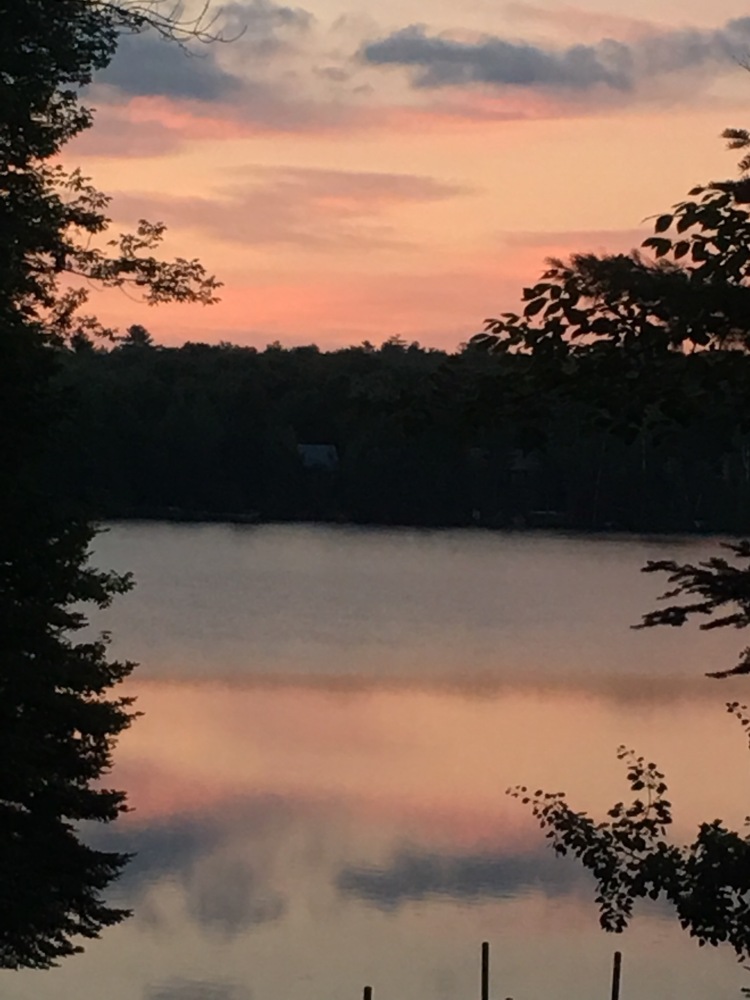
As we sat and enjoyed dinner and the sunsetting on the lake ToT said that she was thinking she needed another day off. Tomorrow’s hike was a tough one – up and over Blue Mountain, the only real climb of the whole trail, and the weather looked terrible. We sat and looked at the map, the schedule and our options and decided that I would do 14-15 miles the next day alone, but ToT and Beth would take a lot of my gear and we would meet up at the Lake Durant Campsite the following day.
The Thru-Hikers Journey
When we set out to do this hike we knew we were both on our own journeys. I love being in the woods and was looking for a unique experience and an opportunity to meet other people learn more about this crazy world of thru-hiking. ToT is a single mom with 16 year old twin boys. Her reasons for undertaking this and her journey were different from mine. The first four days in the woods were very emotional for her and to keep going she needed a break. I also was interested in hiking alone – just to see what it is like. I’m a social person and not used to spending much time by myself so this was a part of my personal growth as well. Plus, to do this section without a full pack seemed like a dream.
Section Two: Long Lake to Wakely Dam
Day 5: Up and Over Blue Mountain
I woke up early the next morning and stopped to get coffee and a breakfast sandwich on my way back to the trailhead. Beth dropped me off around 7:30 and I took off. I was only carrying my pack with some food for the day, water, medical supplies and navigational stuff. I felt like I could walk forever with such a lightened load. Good thing – because I was in a rush! I knew a weather system was approaching and I wanted to be up and over that damn mountain before it started storming.
The hike over Blue Mountain SOBO was tough and there is no view at the top. Nevermind, I wasn’t stopping anyway. I hiked up and down and out to Tirrell Pond with the sound of thunder in the distance. I had cell service the whole way and took the time to call a few good friends and check in. So much for hiking alone, lol. Chatting made the time go by.
I hit the Tirrell Pond LT and it was devoid of people. In fact, I didn’t see a single soul the entire 15 miles I hiked. I was curious about Tirrell Pong because I had read a lot about its use (or overuse) by people who fly in by float plane and party there. The LT definitely had more trash than others we had been to which was disappointing. It’s just disrespectful to leave your trash behind in the wilderness.
I blasted past Tirrell Pond LT and headed for O’Neil Flow LT keeping my fingers crossed that I would miss the worst of the storm. But by this time it was raining pretty hard and I was just soaked. No thunder and lightening yet though. I came to a bit of a sketchy looking crossing before the LT but didn’t have time to think about it before hurrying over the slippery logs and landing in the LT just as the thunder and lightening started.
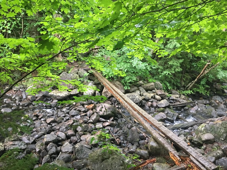
I checked out the radar on my cell phone (yay for service!) and finally decided it was a good time to head back out. I started walking on a trail by the LT and realized it wasn’t the right trail. So I tried another one…and another one. Eventually I became aware of the fact that something wasn’t right. I headed back to the LT and pulled out my map, compass, and trail guide. In my rush to get to the LT before the storm I didn’t realize that I had used a side access trail. I needed to back track over that trail to get back to the main trail. So, back over the hazardous log bridge to the main trail I went. I was grateful for the opportunity to test of my navigational skills but kind of regretting that I didn’t have all of my gear. If there had been a real emergency I would have preferred to hike over that mountain with a full pack, in retrospect. Lessons learned, I moved on.
The rest of the hike was flat and uneventful. As I neared our rendezvous point I got to thinking about just how wet I was. My sneakers and socks were saturated. My pack was wet. Everything was wet. I decided that if I could get in touch with my mom it might make sense to spend the night at my parents camp in Indian Lake, about a 10 minute drive from the Lake Durant Campground, and dry all my stuff. I made some calls and everyone was happy with this plan. We ditched the campsite at Lake Durant and Beth drove me and ToT to my parents camp in Indian Lake. We had a fun night hanging out with my folks and I got everything washed and dried. I was regretting spending another night inside (I love camping and sleeping in my hammock) so, much to my mother’s bewilderment, I pitched up my hammock and slept outside that night. After nearly 15 miles on the trail, and a bit of a stressful day, it was one of the best sleeps I ever gotten!
Day 6: ToT and I head out together again!
Beth brought us back to the trailhead at Lake Durant the next morning and said good bye to us there. We were so grateful for all the help and support Beth gave us. It made such a difference in our overall experience and really helped us accomplish the whole undertaking.
 At this point we were a little ahead of our preplanned schedule and totally off of the schedule in terms of where we had planned on stopping each night. Originally we had planned to meet another friend to section hike with us at Wakely Dam the following evening but at this point we would hit Wakely Dam that night. We got in touch with our friend, Top of the Line (TOTL) and decided to meet him at the Dam the following morning and adjusted our campsite selections accordingly.
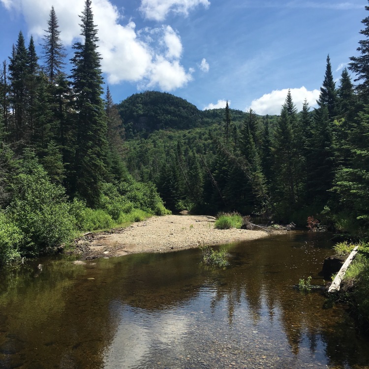
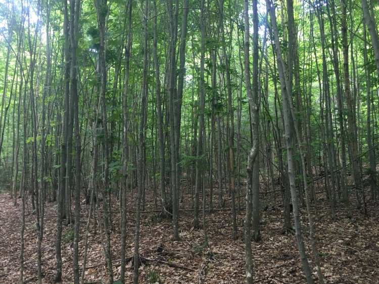
The hike from Lake Durant to Wakely Dam was pretty monotonous. There was not a lot of variation in the scenery and few points of interest to indicate how far we had hiked. I did enjoy hiking through a new growth forest and seeing all the baby trees – and also appreciated the “large glacial erratic” that we passed – but that’s about all I can comment on for this section.
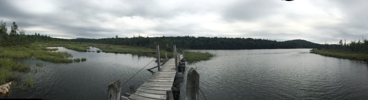
We hit Wakely Dam at the end of a short road walk and what we saw was not exactly what we had expected. Wakely Dam is a free RV campground and at first glance it’s not that pretty. I guess we had been a bit spoiled on the walk from Lake Placid to Long Lake…
We also hit Wakely Dam on a Saturday of a sunny summer weekend – quite possibly the worst time to hit this location. All of the sites were full with giant RVs, trucks, generators, boats, and people. It was a shock to the senses after seeing almost no one along the trail so far. We wandered around wondering where the heck we were going to camp and finally talked to this very lovely woman who gave us some great information. She had a map of the campground and there were two sites that were only accessible by walking or boating.
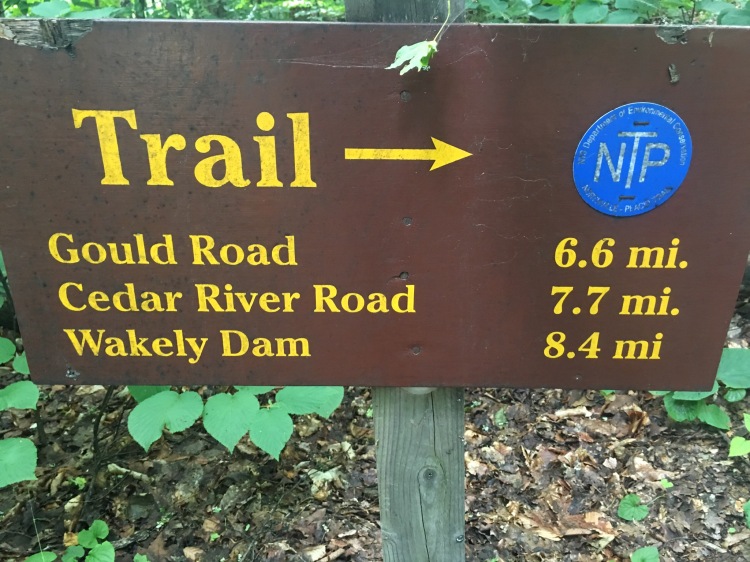
If anyone reading this finds themselves in this situation in the future please note that the access to these sites is via a short trail from the first campsite on the right when you walk over the dam. Unfortunately for us the campsite we had to walk through was full of men and we were a bit intimidated. When we walked over they were very friendly but I could tell ToT was on edge, and so was I. The two campsites that we came to were very nice – the nicest by far at this location. We ended up using both the sites – one was better for pitching a tent and a hammock and the other had a helpful picnic table. No one else was back there so we had the place to ourselves, although the buzz of the generators and drone of people and activity was noticeable all night long.
As we were getting our camp set up a man from the access campsite wandered back drinking a cheap beer and smoking a cigarette. He started talking and quickly we learned way more about this person than I could have imagined possible. He was actually a very nice man but his endless stories about needing to start Chantix and his recent triple bypass surgery were nothing if not ironic to listen to in the middle of a 136 mile trek through the Dacks. He capped off his story by reassuring us that we were safe – he was packing some firearms and firmly believed in shooting first and asking questions later. Plus he was going to pray for us on the rest of our journey…We were praying he could make it back to his campsite. The two minute walk in was the most he had walked in years and I wasn’t convinced he could a) find his way back or b) make it all that way. It was going to be a long night.
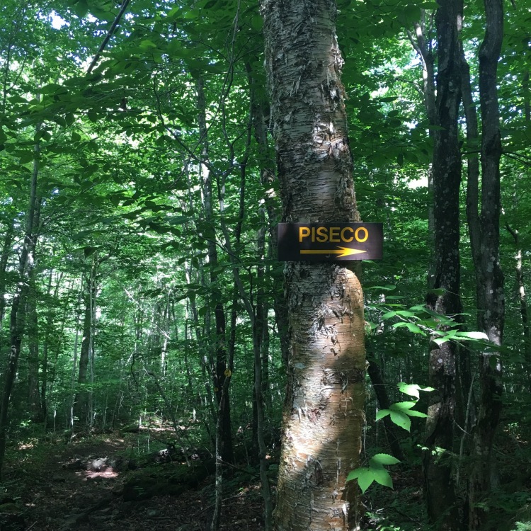
Section Three: Wakely Dam to Piseco
Day 7: On the road again!
The magical thing about thru hiking is that your body has no choice but to sleep. The next morning came around quickly and we packed up and got the hell out of there. We planned to meet with TOTL at 9am at the entrance to Wakely Dam and we all showed up right on time. My parents – who deserve a huge shoutout for all there help and support with this whole thing – had met TOTL in Piseco that morning where he left his truck and gave him a ride up to Wakely Dam. Thank you mom and dad.
What is the name Top of the Line all about?
When TOTL got out of the car I was shocked at the size of his backpack. He was carrying a 90L backpack. 90L! For months I had been going on and on about ultralight backpacking and how amazing it was how much gear has evolved…and then he shows up with all this Top of the Line backpacking gear…. circa 1991. I am pretty certain that his sleeping bag alone weighed more than my entire backpack fully packed.
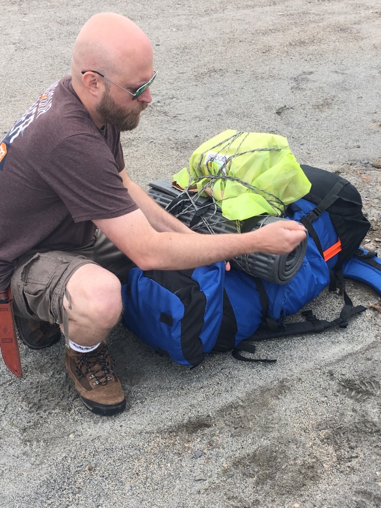
The humorous thing about TOTL is that he was fairly defensive about his gear. After all, it was all top of the line stuff. He was certain that there was not that much of a difference between his stuff and our stuff and besides he is stronger than us and his legs were fresh… he had no concerns about any of this.
Our goal that day was to hit a LT or campsite at the Cedar Lake/Beaver Pond area. Again, it was a weekend night and there was a good chance we would run into other people on the trail. The hike along the Cedar River Flow was very pretty and we quickly fell into a joking banter that lasted the entire three days TOTL was with us. ToT’s tears (mostly) dried up and were replaced by laughter and I was psyched to have some quality time with one of my oldest friends. TOTLs gear proved to be a constant source of entertainment and TOTL and ToT decided that my hike so far was one big, bad e-dating profile. I frequently had to defend myself to them after chatting it up for too long with people on the trail and finding apparently too many positive qualities in literally everyone that we met.
“I just like to meet people and have fun,” mocked TOTL, “She enjoys going out and staying in,” added ToT. “Stop! What’s wrong with meeting people, laughing and enjoying life?” I would say in my own defense. I swear, the two of them acted like everyone we came across was a serial killer. I didn’t know it at the time but my trail name was born in these days.
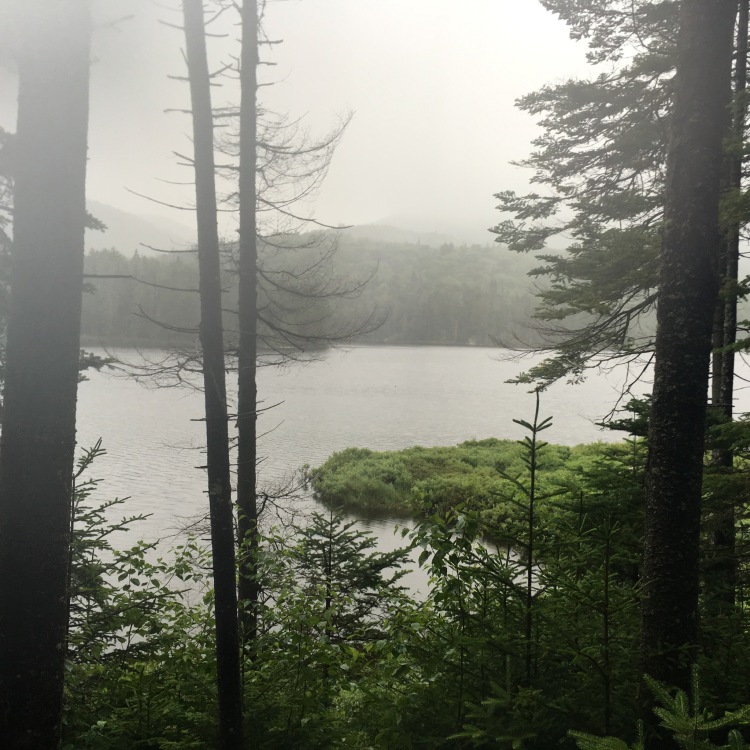
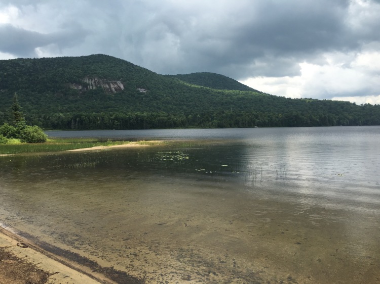
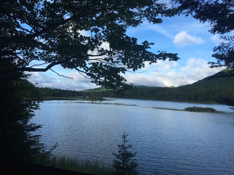
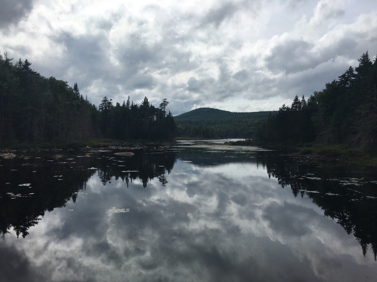
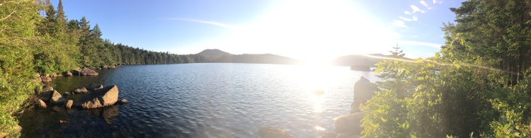
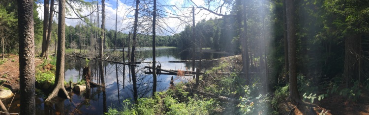
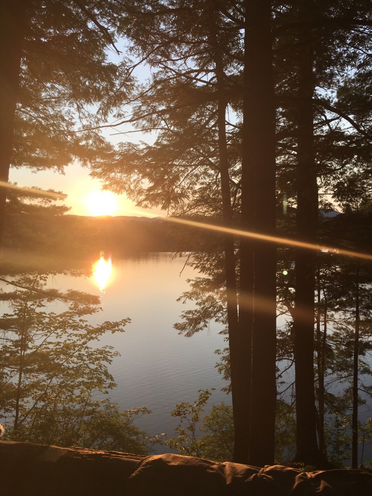
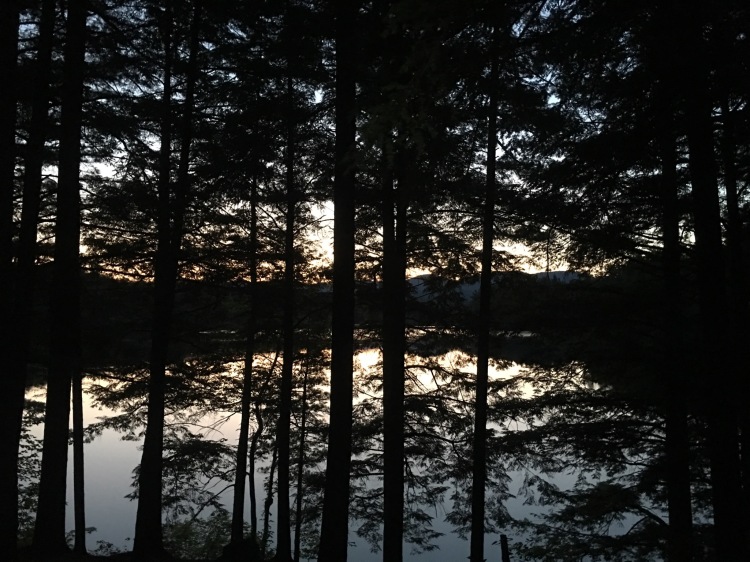
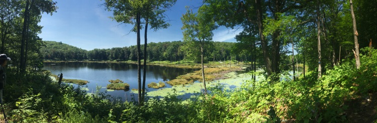
When we got to the Cedar Lake area the first LT was taken. There was a campsite available and the next LT was also taken. We settled into the campsite and explored the area. I couldn’t believe there was such an enormous untouched lake like this one (if only I knew what was yet to come!).
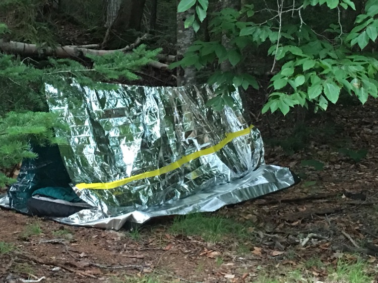
Perhaps the funniest part of our trip occurred that night. We had been joking about TOTLs ancient gear for the entire day but it turns out that he had just purchased a new tent. Except his ex-girlfriend took it when she moved out a few months earlier. So, in a last minute attempt to replace his tent, TOTL grabbed an emergency shelter from WalMart. For all the stuff he was dragging along, a small, lightweight emergency shelter was so out of place. And hilarious too. It was like he had encased himself in a giant role of alumium foil. Every time he shifted in the shelter it could be heard for miles around. And with no actually protection from bugs he had to sleep with a mosquito net covering his head. Hil-ar-ious. But I’ll give him this: it was a top of the line emergency shelter from 2016. And it could possibly be used to signal aircraft in the event of a real emergency.
Day 8: My favorite day on the trail!
We woke up on Day 8 to an absolutely beautiful day. We discussed how far we were going to hike today and ultimately decided that if we found a beautiful site we would stop and spend the day there without feeling pressure to hike our usual 10-12 miles. We were already ahead of schedule anyway and one thing I was slightly regretting is that we were not spending a lot of time at these beautiful locations.
It turned out that we didn’t need to walk far to find the perfect spot to spend a beautiful day. After about 5 miles we came to West Lake Lean To #1 and it was so picture perfect that we decided to relax spend the whole afternoon there.
We spend the day swimming, rinsing out all of our clothing, airing out all of our gear and just relaxing. After feeling like we needed to go-go-go for the past seven days this was the perfect place to rejuvenate. And now we were back on our original schedule.
Day 9: It rained, again.
We woke up early and set out on the trail once again. Our goal was to make it to the Fall Stream Campsite, 4.2 miles outside of Piseco, where TOTL would be leaving the trail. The morning was overcast and I felt sure it was going to start raining. We were moving quickly because we thought we could hit a LT and take a break during the storm that was approaching. We hit one LT and chatted with a guy that was there with his dog. (I thought he was a nice guy with a friendly dog, TOTL said he was a classic murderer and ToT said it didn’t seem like he belonged in the wilderness. What is wrong with these people?!)
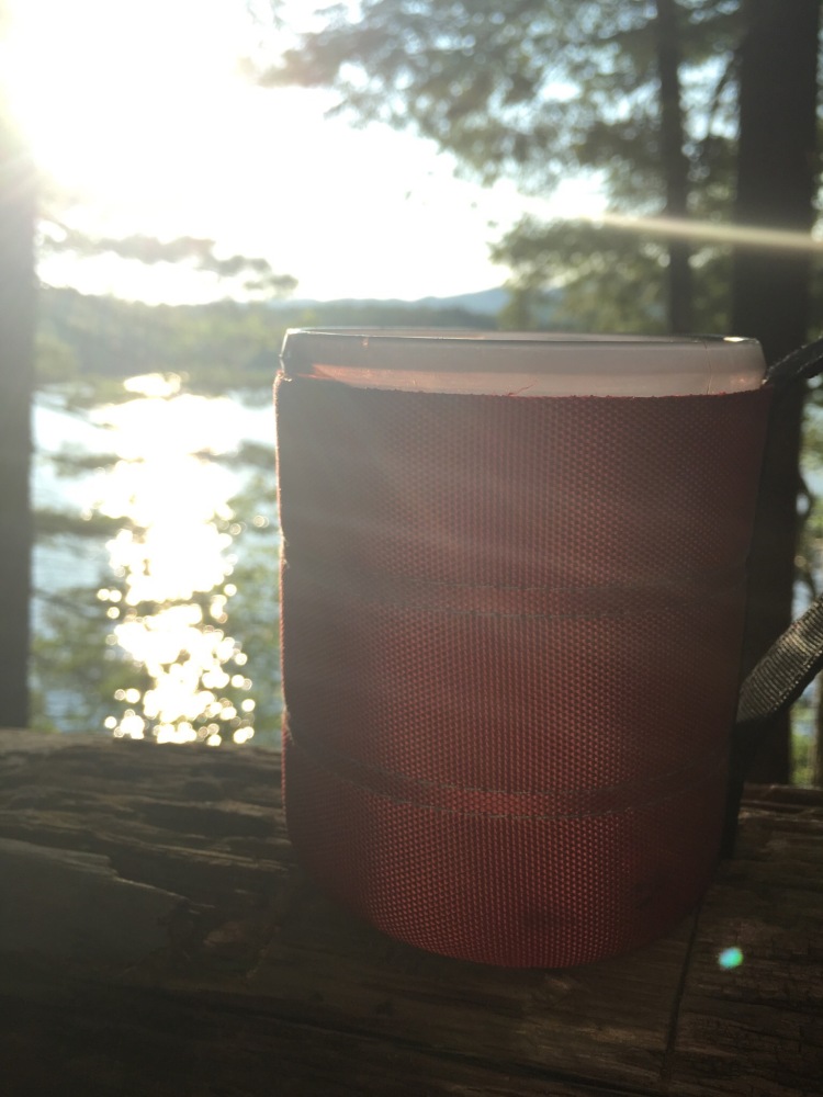
Walking 10, 12, or 15 miles a day is a lot. There comes a point where you need something more to keep you going. One of the best things that I packed for this trip was a UEBoom. It’s a bluetooth speaker with amazing sound quality and it was totally worth the weight sacrifice to bring it along. I was streaming music and comedy tracks when the hiking got tought and at night while we were setting up camp. The entertainment really helped us keep moving forward. Of course if we came upon other people on the trail we turned it right off because we didn’t want to be rude.
At about 11:00 on this particular morning we were hiking along at a brisk pace listening to music and we came to another LT right on the trail. The music was loud enough for all of us to listen easily but as we got closer we turned it down because it was obvious that this LT was occupied. We got to the LT and there was a man sleeping in the LT. He had not woken up from our music or the general noise of our approach and he was snoring loudly. It was a confusing sight to behold and we all quietly panicked in our own individual confused ways. I slowed down to ascertain which way the trail went but TOTL who was behind me was too busy gaping at the man sleeping and smashed right into me – which caused a domino effect and I crashed into ToT. Throughout this entire bizarre display the man never stopped snoring. We all rebalanced ourselves and kept on moving. I had to concede on this point – that scene seemed out of place out here.
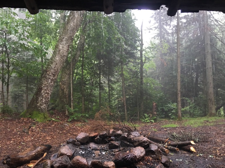
By now we could hear thunder in the distance and I fell into drill sergeant mode ordering everyone to move QUICKLY! We made it to the next LT just as the raindrops started to fall. We snacked a little and watched the storm roll in. Before we knew it it was pouring. We each pulled out some makeshift beds and napped or read in the LT while it rained. The storm lasted two hours and we were lucky to be under cover the whole time. We were back on the trail around 3:00.
Although it had stopped raining the weather was hot, humid and very buggy. It was gross! We hiked on and hit our campsite around 5:30 or so. At this point ToT announced that she wanted to push on to Piseco. We were wet with sweat, covered with bug bites and being absolutely swarmed by deer flies and mosquitos. Piseco was another 4.2 miles out — so another 15 mile day. I voted to stay and camp because I love camping but TOTL voted to keep on trucking. Finding myself in the minority we refilled our water and continued on to Piseco. After another mile or so I had cell reception and I called the Oxbow Motel to see if we could spend the night there. They were so friendly and nice – they said just grab a key from the key board and settle up for the room in the morning.
We hauled ass on this last 4.2 miles and made it out of the woods by 8:00. TOTLs truck was a welcome site at the end of that long stretch of hiking. We hit Casey’s store for Poland Spring water and beers and ordered some burgers from some place in Speculator. TOTL picked up the burgers, we all showered up and spent a very lovely evening drinking beers, checking in with family and seriously reducing our packs to the bare minimum for the last stretch of trail.
Section Four: Piseco to Northville
Day 10: The final stretch
We hit the trail again early in the AM. Planning our camping stops was a little trickier on this section as there are fewer designated camping sites and LTs between Piseco and Northville. Our plan today was to hit Silver Lake LT but if we felt exhausted we could stop two miles short of that and camp at Canary Pond.
The hike today was the busiest section we’d hiked yet. We ran into two section hikers, one thru hiker and two groups of three each thru hikers. The thru hikers had all set out on the same day which was oddly bad timing for them. There were no other groups that set off a few days before or after them. We had only seen a handful of other NOBO thru hikers on the entire trail so far. I considered the universal chaos theory to explain something like this for many hours while hiking that day. Anyway, I loved stopping and chatting with everyone. I do wish the trail was a little more populated in general. I loved hearing about everyone else’s itineraries, past experiences, reasons for hiking, etc. ToT was taking copious mental notes on my overtly friendly behavior to share with TOTL later on.
We made it to Canary Pond and the site was gorgeous. I really wanted to stay and camp but ToT wanted to continue to the Silver Lake LT – our last LT option on the trail. I conceded and we hiked another two miles to Silver Lake. This two mile evening hike was one of my favorite hikes on the trail. The weather was perfect, the forest was enchanting and I was able to immerse myself in just hiking. The trail was in great condition without a lot of obstacles to negotiate and I was so grateful for the opportunity to be out there at that moment.
Day 11: Silver Lake to Woods Lake
Our second to last day of hiking. I was having mixed feelings about being so close to the end of this journey but by this point I was ready to wrap up the hiking and see my family. Honestly the section from Piseco to Northville was the least inspiring part of the hike in my opinion. This section in particular seemed to go on for ages and ages. Switchback after switchback and not many unique features made the miles feel twice as long plus we were anxious to be done.
We finally made it to the Woods Lake campground. Woods Lake is another beautiful setting but both ToT and I instantly felt like something was off. We had that inexplicable bad feeling. We could hear people but not see anyone, smell a campfire but couldn’t find another person, and there was drug paraphernalia near the campsite. Perhaps this all contributed to our feeling but either way, something was off.
We weren’t keen on staying here and thought maybe we should walk a little further. The campsite is only 1/4 mile from the road so we went out to the road and looked at the map. There was literally no where else to camp and no town nearby, plus no cell service. In the parking lot we met a woman who had been camping with her family at this site for a week and she assured us that everyone who had been through the site was on the up and up and they had run into no problems whatsoever.
Feeling better about our predicament we hiked back in and set up camp. As we were setting up and swimming the family that was camping there (who we could not actually see from our site but I am guessing they were about 1/4 – 1/3 mile away from us) was making a lot of noise. The dad was obnoxiously yelling as loud as he could: “ANYONE SEE MY DOG?” and other random stuff. It was clear that he was making an effort to be loud and unpleasant but also that he was intoxicated. The yelling just continued into the night. I fell into a sound sleep at 9:30 only to be woken up at 11:30 but this rude asshole screaming “WAKE UP. EVERYONE WAKE UP,” and then we could hear him arguing with his wife. ToT was feeling very uneasy and I was none to pleased to have walked from freaking Lake Placid only to deal with this moron on our last night in the woods.
It was really difficult to get to sleep after the commotion (we even considered leaving but where could we go?) but eventually this guy must have passed out and we alternated between sleeping and waking up until the sun came up at 5am. As soon as it was light out we packed up our stuff and hightailed it out of there. 12 miles to the finish…
Sidenote: We did have a few minutes to sit and drink some wine before the craziness of the night happened. During this time we laughed, cried and toasted to the journey we were about to conclude. ToT ceremoniously bestowed upon me my trail name: Loves to Laugh. She said that Loves to Laugh lead us along in the beginning, with the Trail of Tears following behind. I loved the name. Then when I got home I totally f*ed and forgot that it was loves to laugh and thought it was likes to laugh and went and got this url to start my backpacking blog. Oops! Has No Memory would have also been an appropriate name.
Day 12: The end.
The hike on day 11 was long and painful but Day 12 felt pretty good. We were both emotional and I cried almost as much as ToT had in the beginning. We were on the trail by 6:30am – a record shattering start for us – and so we were about 3 hours ahead of schedule. We finally had cell service a few miles outside of Northville so I began to frantically text our families and let them know we would be at the end much earlier than expected.
The hike culminated with an awesome 3.5 mile road walk. Is there anything more awful than hiking 133 miles and then being spit out on a hot, busy road? No, no there is not. ToT just about threw in the towel a half mile before the finish but then she spotted a Stewarts on the horizon and took off like a racehorse chasing after her Poland Spring water.
Final Thoughts
In the beginning I set out to have an adventure and that is exactly what this was. An amazing adventure. We were plucked from reality and spent 12 days in an alternate universe that most people are not even aware exists. I don’t want to overstate it and say it was life changing (although it was) but at a minimum it was clearly life enhancing. I returned to the everyday filled with more gratitude, excited about life, and ready for whatever comes next.
A very special thank you to everyone who helped make this happen: our families and friends, the volunteer trail crews who maintain the trail, the NPT people who devote time and energy to sharing information about this special place and everyone who found words of encouragement and support before, during and after this journey. Thank you.

Sounds awesome,would lovev to hike the whole northville placid trail!!
LikeLike
Thanks for the comment! You should do it!!!
LikeLike
I love every word of this. And you. I love you, too 🙂 You’ve inspired me….not I just need to know where to go from here. xoxo
LikeLike
Just go! Anywhere. (But preferably somewhere with me)! And really Erin, YOU inspired me first. You’re the winner. 🙂
LikeLike
It was so great to read about your adventure! I’ve been thinking about taking up hiking and Im motivated by reading your blog. Congratulations to you and Natalie for completing the trip and fulfilling a goal!
LikeLike
Thanks Aimee! I would strongly encourage you to take up hiking. It’s therapeutic!
LikeLike
I didn’t have time to read the whole thing, but the pictures are awesome! It looks like you had a great time. I’m jealous.
LikeLiked by 1 person
🙂
LikeLike
Jes! I loved reading about your adventure. What an accomplishment! I love hiking, but I don’t know if I would ever be up to something like that. You go girl!
LikeLike
My boyfriend & I are doing a thru hike NOBO at the end of the month & this has me so excited! How many miles was your longest day & how long did it take? We’re still messing around with our itinerary.
LikeLike
Just wondering what you did with your food at night. Did you have a bear canister or hang it in a tree?
LikeLike
We used a bear canister and it worked really well!
LikeLiked by 1 person
Great trip report! Awesome writing, thank you so much for sharing!
LikeLike
Thanks Marj! Have a great trip!
LikeLike
There never was a bridge over the 90′ West Stony Creek.
LikeLike